Mapping Israel’s 300 West Bank checkpoints: functions and impact
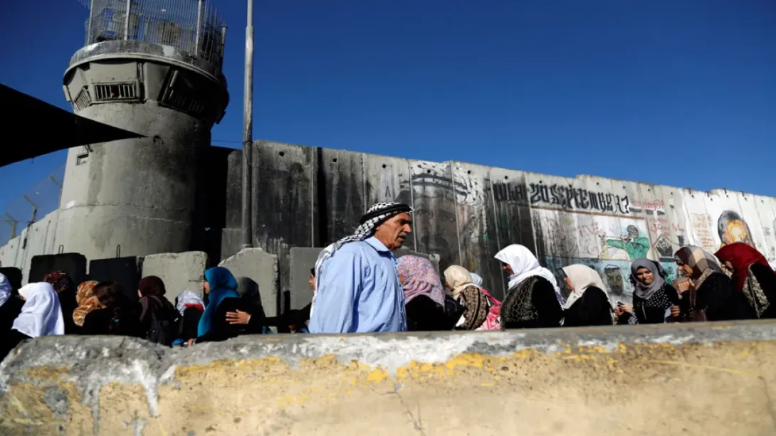
Israel operates more than 300 checkpoints across the occupied West Bank, comprising a complex network of staffed checkpoints, gates, roadblocks and earthworks that severely restrict Palestinian movement, especially during temporary closures like holidays.
The Short Answer
Israel enforces a network of over 300 checkpoints across the occupied West Bank—including staffed, intermittent, and physical barriers such as gates and roadblocks—that severely limit Palestinian mobility, restrict access to work, healthcare and holy sites, and intensify during closures like the current Sukkot lockdown.
Focal Facts
- Over 300 Israeli checkpoints are in operation across the West Bank and East Jerusalem.
- Checkpoints include fully staffed, partial, and unmanned physical barriers like gates, earth mounds and roadblocks.
- Main checkpoints include Qalandiya, Checkpoint 300, Eyal, Taybeh and Tarqumiyah.
- During the week‑long Sukkot closure starting 28 September 2026, crossings to multiple towns and holy sites were shut.
- Before October 2023, 160,000 Palestinians worked inside Israel; by mid‑2024, only ~27,300 could continue.
- Unemployment in the West Bank rose from ~13% to ~30% in about one year.
Full Explanation
Israeli authorities operate a sprawling network of over 300 checkpoints across the occupied West Bank—ranging from fully staffed crossings to intermittently manned gates, earth mounds and roadblocks—creating one of the most restrictive mobility environments in the world. During times of heightened control, such as the current Sukkot lockdown initiated on September 28, 2026, the system tightens further, barring Palestinians from key roads, holy sites and towns.
How many checkpoints exist and what forms do they take?
According to the UN Office for the Coordination of Humanitarian Affairs, as of December 2025 there were more than 300 Israeli checkpoints peppered across the West Bank and East Jerusalem, embedded within a broader system of 925 movement obstacles. These include 89 checkpoints staffed 24/7; 218 partial checkpoints with intermittent staffing (152 with gates, with about 90 usually open and 62 frequently closed); 232 road gates (159 often closed); 114 linear closures such as walls, trenches or road barriers; 167 earth mounds; and 105 roadblocks ([aljazeera.com](https://www.aljazeera.com/news/2026/9/28/mapping-israels-300-checkpoints-where-they-are-and-how-they-work)).
Where are the most significant checkpoints located?
Several key crossings structure mobility across regions. The Qalandiya checkpoint lies between Ramallah and East Jerusalem and once handled roughly one‑third of travel between the West Bank and Israel. Checkpoint 300 stands on the Bethlehem–Jerusalem road, serving as the main artery for Palestinians commuting into central cities. In addition, Eyal checkpoint facilitates movement for workers from Qalqilya in the north; Taybeh lies near Tulkarem; and Tarqumiyah serves southern Hebron communities ([aljazeera.com](https://www.aljazeera.com/news/2026/9/28/mapping-israels-300-checkpoints-where-they-are-and-how-they-work)).
What happens during temporary closures like the Sukkot lockdown?
On September 28, 2026, Defense Minister Israel Katz, acting on military advice, ordered a week‑long lockdown of West Bank crossings. The decree closed access to towns including Turmus Aya, Aboud, Nabi Saleh, Atara, and Taybeh; troops set up new checkpoints in Yabroud, Ein Siniya, and Jaba to check IDs and search vehicles. The closure also prevented most Palestinians holding work permits from entering Israel or settlement industrial zones—they were already reduced after October 2023—while denying access to holy sites such as Al‑Aqsa in Jerusalem and the Ibrahimi Mosque in Hebron ([aljazeera.com](https://www.aljazeera.com/news/2026/9/28/mapping-israels-300-checkpoints-where-they-are-and-how-they-work)).
Why does movement matter—and what is the broader impact?
For decades, Palestinians have relied on access within Israel and East Jerusalem for employment, healthcare, education, and religious life. Before October 2023, about 160,000 West Bank residents worked inside Israel or settlements. By mid‑2024, that number plummeted to roughly 27,300, driving unemployment from about 13 percent in September 2023 to over 30 percent a year later ([aljazeera.com](https://www.aljazeera.com/news/2026/9/28/mapping-israels-300-checkpoints-where-they-are-and-how-they-work)). The control architecture of checkpoints helps enforce occupation policy and effectively isolates Palestinian communities, undercutting economic opportunity and disrupting essential services.
How does this system function in practice?
Checkpoints range from fixed staffed crossings to shifting barriers. Staffed checkpoints involve identity and permit checks; partial checkpoints or gates may be closed randomly or serve as pressure points. Earthworks or trenches block passage entirely. The assemblage functions as both a security apparatus and a movement management system—but in practice it regularly strangles normal life for civilians.
In sum, the network of more than 300 checkpoints and accompanying obstacles constitutes a deeply embedded system of spatial control in the occupied West Bank. Its effects are heightened during temporary closures like the current Sukkot lockdown, revealing the fragility of Palestinian mobility under occupation.
Focal Verification
Verified journalistic reporting based on data from UN OCHA and Al Jazeera.
Key Actors
- Israel — Operating authority
- Palestinians — Population restricted
- UN Office for the Coordination of Humanitarian Affairs (OCHA) — Data source
- Al Jazeera — Reporting source
Focal Timeline
- September 28 2026Israel imposes week-long West Bank lockdown for Sukkot, sealing crossings and tightening movement restrictions
- December 2025UN records over 300 Israeli checkpoints among 925 movement obstacles across West Bank and East Jerusalem
Focal Evidence
The network comprises more than 300 checkpoints—89 staffed 24/7, 218 intermittent, numerous gates, roadblocks and earth barriers—part of 925 formal obstacles restricting movement across the West Bank and East Jerusalem as of December 2025 ([aljazeera.com](https://www.aljazeera.com/news/2026/9/28/mapping-israels-300-checkpoints-where-they-are-and-how-they-work)). During the week‑long Sukkot closure beginning September 28 2026, Israel sealed West Bank crossings and blocked entrances to towns like Turmus Aya, Aboud, Nabi Saleh and Taybeh, tightening access to holy sites including Al‑Aqsa and Ibrahimi mosques ([aljazeera.com](https://www.aljazeera.com/news/2026/9/28/mapping-israels-300-checkpoints-where-they-are-and-how-they-work)).
Focal Outlook
- How will movement restrictions change after the Sukkot closure ends?
- What are the humanitarian effects on access to healthcare and education over time?
Focal Update
Summarizes data as of September 28 2026; may require update following end of Sukkot closure.